
Day 10 - Can't be faulted
- Sep 14, 2014
- 3 min read
Today we were ground-truth mapping again, though this time we were in the western part of the caldera. We came across a couple of tuff deposits which we added onto the map as these are not depicted by the landsat images. Again the day was spent picking out different lava flows and attempting to work out the order of eruptions.
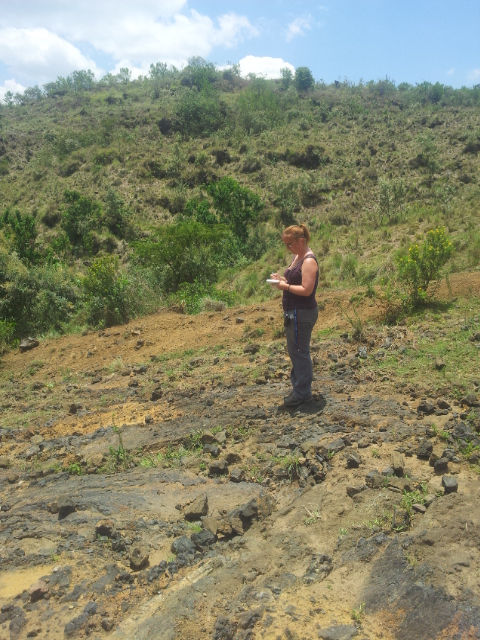
Helen stood on one lava flow, having mapped the flow you can see behind, she is looking across to the third flow in the area taking notes for the map.
We did however come across a nice surprise at the end of the day; a rather big fault. We first noticed the surface of the rock was quite a lot smoother than elsewhere and then on this smooth surface we saw lots of parallel lines. These lines are called slickenlines and are formed during fault movement; one side scratches the rock on the other side of the fault.

The first set of Slickenlines (slicks for short) we saw. By far the biggest and most defined I have ever seen!
We took measurements of the slickenlines, and measured the fault orientation, which was east-west. The slickenlines suggest it is a large normal fault with lots of displacement (movement), and it is the block (rocks) to the north which have been downthrown. In a normal fault the movement is horizontal and as a result one block is downthrown relative to the other.

A cartoon showing a normal fault. The downthrown side is known as the hanging wall, and the other side is known as the footwall.
It was a nice wee surprise to find this fault for two reasons. Firstly the fault has not been mapped before, nor has it been mentioned in any of the literature of the Menengai caldera. This means we are the first people to have discovered this fault :) Also there has been no observation of any major structures with an east-west trend in the caldera. But such structures are not unexpected as there is the large Nyaza rift nearby which has east-west trend. Because the Nyaza rift is part of the East African rift system (and forms a triple junction) we would expect it to have an influence on the structure and tectonics within the caldera. On our way ‘home’ – Maili saba certainly feels like our home away from home- we stopped at one of the small village markets and treated ourselves to some street-corn. Corn-on-the-cob cooked on an open fire. We loved it, especially as some of it was pretty much popcorn!

Enjoying some street-corn on the way home.
As time goes on and we develop a greater understanding of the geology in the caldera some of our initial interpretations can change. With some new information (seeing evidence of hydrothermal alteration elsewhere in the caldera), and on consolidating field notes and the maps, our interpretation of the clay we observed in the quarry on day 8 has changed. We no longer think it is a loess deposit. On reflection, it would be very unlikely for an aeolian environment to have developed without us seeing evidence of a transition. We were simply attempting to explain this rather unusual deposit, and a loess was the best we could think of with the information we had then. Now, having seen hydrothermal alteration in some of the tuff deposits we think the deposit was a feldspar-rich crystal tuff which has altered to clay hydrothermally. Hydrothermal alteration is where hot water (often with dissolved elements such as sulphur) moves through the rock and changes its chemical composition. Feldpar is a type of mineral that alters to clay, hence why we believe the clay was originally a fine-grained tuff composed mostly of small feldspar crystals, which was later hydrothermally altered into the clay we see today. Maisha Nbefu A Swahili saying, meaning 'long life', used in the same way we would say take care.
Comments